
Wakkanai and Cape Soya: A City Built Around Being “the Northernmost Point”
Wakkanai is Japan’s northernmost city, at the very top of Hokkaido’s Soya region, facing Russia’s Sakhalin across the Soya Strait. The sightseeing focus here is very clear: almost every itinerary revolves around the idea of “the northernmost point.”
Is Cape Soya Really Japan’s Northernmost Point? Getting the Wording Right
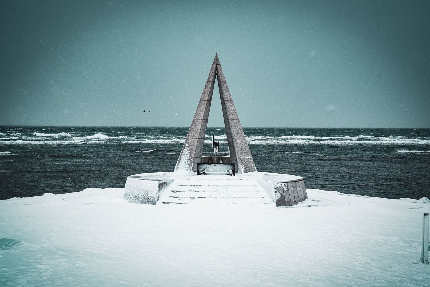
Cape Soya is often called “the northernmost point of Japan,” but it needs a caveat. The Northern Territories (Etorofu and others), over which the Japanese government claims sovereignty, lie at a higher latitude, so strictly speaking Cape Soya is “the northernmost point of Japan that ordinary travelers can actually stand on, excluding the Northern Territories.” In addition, about a kilometer offshore from the cape lies the uninhabited Benten Island, which is farther north than the cape, but there is no scheduled or commercial boat to land there, so you can only view it from a distance. That is why the triangular monument on the cape is the “northernmost point” where visitors take photos, collect stamps and buy certificates.
Who Is Wakkanai For? The Basics of Planning
Wakkanai suits travelers who like “geographic extremes” and wide-open landscapes, and also those who want to hop from Hokkaido to the outer islands. The town itself is small, with main sights clustered around the station and Cape Noshappu to the west, while Cape Soya is about 30 km from town and needs its own half day.
The most comfortable plan is two days and one night: on the first afternoon, arrive and explore town and the sunset at Cape Noshappu, then give the whole second morning to Cape Soya and the Soya Hills. If you also want to add Rishiri or Rebun Island, allow at least two more days.
When to Go: June to September Is the Main Season
Wakkanai’s tourist season is very concentrated. June to September is the best window, with stable weather, ferries and scheduled sightseeing buses running, and Rebun Island’s alpine flowers in bloom. Even in midsummer in July and August the sea wind stays strong and it feels cool, so a long-sleeved jacket is essential, not optional.
Winter in Wakkanai is a different world, with heavy snow and wind, frequent transport suspensions and sharply reduced ferry service to the islands, so it is not recommended for first-time visitors. If you want to see drift ice, Monbetsu and Abashiri on the Sea of Okhotsk side are the main places; Wakkanai is not a core drift-ice viewing area.
What This Article Will Tell You
This article breaks Wakkanai into three layers: how to get here and get around, the 12 highlights in town and at Cape Soya, and costs and itinerary pitfalls. It spends extra space on the fact that the Tenpoku Soya Misaki Line bus runs very rarely, because this is the trap travelers without a car fall into most often.
It also covers ferry crossings and reference fares to Rishiri and Rebun Islands, so anyone who wants to extend the trip farther north has a starting point. All fares and schedules are marked as subject to the operator’s announcements on the day, because seasonal adjustments in northern Hokkaido are very frequent.
How to Get to and Around Wakkanai: Flights, the Limited Express Soya and the Cape Soya Bus Compared
Wakkanai is one of the farthest corners of Hokkaido, and simply “how to get there” decides half the trip. Here are the four ways in and out, plus getting around town, all in one place.
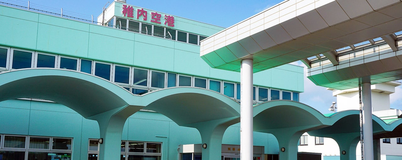
Flying to Wakkanai Airport: The Fastest Way In and Out
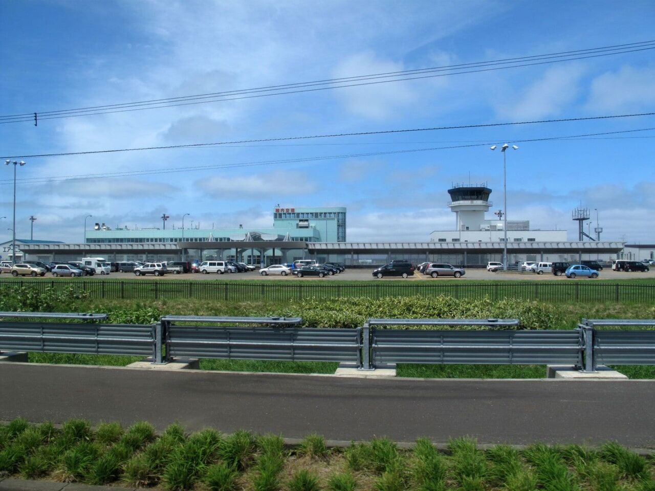
It is about 2 hours by air from Tokyo Haneda to Wakkanai Airport and about 1 hour from Sapporo New Chitose, the fastest options. The airport shuttle bus is timed to flights and takes about 35 minutes, ¥800 one way for adults and ¥400 for children. No reservation is needed, and it accepts cash or PayPay only, not credit cards or transport IC cards.
Wakkanai Airport has few flights, and in winter they are more likely to be canceled or diverted by strong wind and fog than at other Hokkaido airports, so do not schedule connecting flights or plans too tightly on the way back. Actual flights, schedules and fares are as announced by the airlines and bus operator on the day.
JR Limited Express Soya: Arriving at Japan’s Northernmost Station
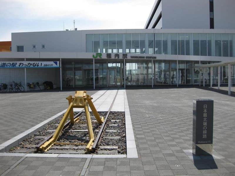
The Limited Express “Soya” from Sapporo runs directly to JR Wakkanai Station, only once a day (departing Sapporo 07:30, arriving Wakkanai 12:42). The trip takes 5 hours 12 minutes, and a one-way ticket with a reserved-seat limited express surcharge is about ¥11,420. JR Wakkanai Station is Japan’s northernmost railway station, and a “northernmost railway line” marker stands at the end of the platform, an attraction in itself. With few trains and delays hard to recover from, plan this as its own leg of the trip. The station also houses a roadside station (michi-no-eki) and a tourist information desk, the first stop for gathering information after you arrive. Actual schedules and fares are as announced by JR Hokkaido on the day.
Wakkanai Town to Cape Soya: The Schedule Trap of the Tenpoku Soya Misaki Line Bus
Travelers without a car should take the “Tenpoku Soya Misaki Line” from in front of Wakkanai Station to the “Soyamisaki” stop (not the terminus, so press the stop button). The ride takes about 50 minutes and costs ¥1,600 one way.
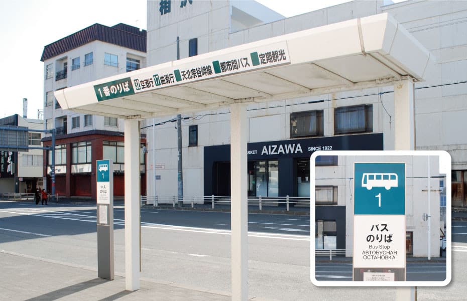
This line has only four runs each way, the last return is at 15:20, and the 16:12 and 19:30 outbound runs cannot return the same day. Workable combinations are the 09:30 out with the 11:04 or 15:20 back, and the 13:30 out with the 15:20 back. There is only one timetable all year, and missing the last bus could mean a taxi fare of over ¥10,000, so confirm the times in advance and photograph the return bus stop sign.
Rental Car and Scheduled Sightseeing Bus: Two Stress-Free Solutions
Driving gives the most mobility in Wakkanai. It is about 30 km and 40 minutes by car from town to Cape Soya, and the White Road in the Soya Hills is a gravel road where navigation systems struggle to locate you, so it is basically reachable only by car. There are rental car offices at Wakkanai Station and at the airport.
If you do not want to drive and worry about bus schedules, look at the summer scheduled sightseeing bus tours (the 2026 operating periods were 5/3-5/5 and 5/20-9/30 and have ended; for 2027, go by the operator’s announcement). The morning Wakkanai A route takes 3 hours 50 minutes and costs ¥3,600 for adults, and the afternoon Wakkanai B route takes 4 hours 15 minutes and costs ¥3,900 for adults. Both are half-day tours that require reservations, which open two months before departure, and cover Cape Soya and nearby sights in one trip. Actual routes, operating periods and fees are as announced by the operator each year.

What Are Wakkanai’s Must-See Sights? 12 Highlights at Cape Soya, the Soya Hills and in Town
Wakkanai’s sights fall into two areas: the Cape Soya and Soya Hills area, and Wakkanai town plus Cape Noshappu to the west. The two are about 30 km apart, so it is best to visit them in separate half days.
Northernmost Point Monument of Japan: The Destination of the Whole Trip
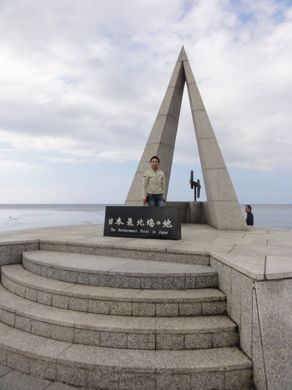
The triangular monument standing at the tip of Cape Soya is modeled on one point of the North Star and is one of the most recognizable geographic-extreme landmarks in all of Japan. The base is engraved with the coordinates 45°31’22” north latitude, and almost everyone lines up to take a photo here.
On a clear day, you can see the outline of Sakhalin about 43 km away across the sea behind the monument, the moment that most feels like a “national border.” The area around the monument is open space, accessible 24 hours a day all year with no admission fee. The sea wind is very strong, so keep your hat in your bag before you get out.

Mamiya Rinzo Statue and the Tower of Prayer: Two Memorials on the Cape
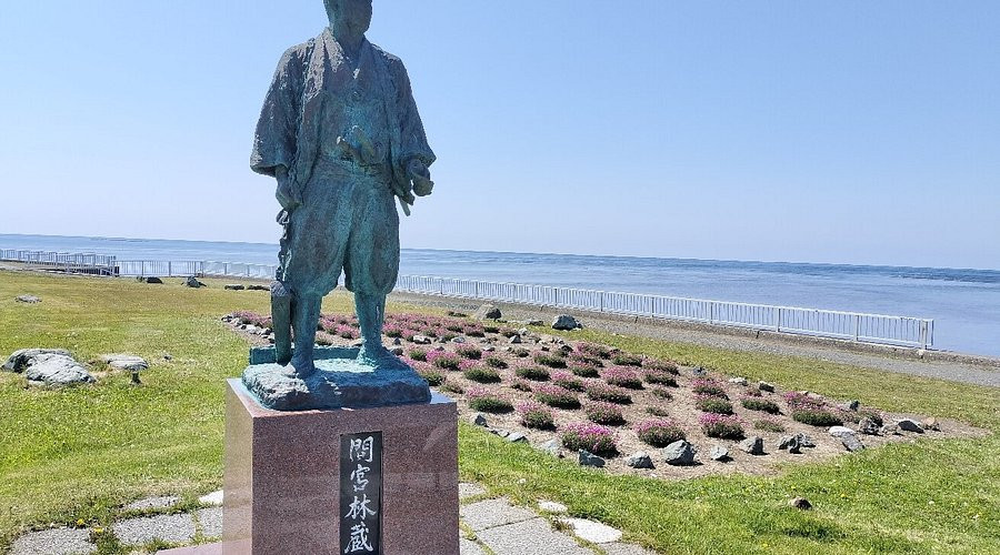
On the high ground next to the monument stands a statue of Mamiya Rinzo. An Edo-period explorer, he set out from this area to survey Karafuto (Sakhalin) and proved it was an island, and the statue faces the direction he sailed from.
On the other side stands the Tower of Prayer, shaped like a paper crane, built in memory of the passengers who died in the 1983 Korean Air Flight 007 incident. Together the two memorials make Cape Soya more than a photo stop, a historical site with weight. Visiting is free, and it is worth slowing down for a walk around.
Cape Soya Park and the Music Monument: Climb Up to See the Whole Strait
Walking up the stairs behind the monument takes you into Cape Soya Park. The park spreads across a slope, with a wider view than the cape itself, taking in the entire Soya Strait and every memorial on the cape at once.
The park has a music monument that plays the famous 1976 song “Soya Misaki,” which many Japanese visitors think of as the soundtrack of this place. The slope is not steep but the wind is stronger, and when snow lies in winter the steps are slippery, so wear non-slip shoes. The park is open to visitors with no admission fee.
Former Misaki Naval Lookout: One of Hokkaido’s Oldest Military Remains
The stone building high in Cape Soya Park is a naval lookout built in the Meiji era to watch the Soya Strait, actually used during the Russo-Japanese War, and later designated a tangible cultural property of Hokkaido.
The building itself is small, but standing beside it and looking down, you can see why the observation post was placed here: the whole strait lies in view. The exterior can be viewed freely, and the interior is usually closed. It is about a ten-minute walk up from the monument, and walking the park on the way is the most efficient way to see both.
Soya Hills: Wave-Shaped Terrain Left by the Ice Age Ten Thousand Years Ago
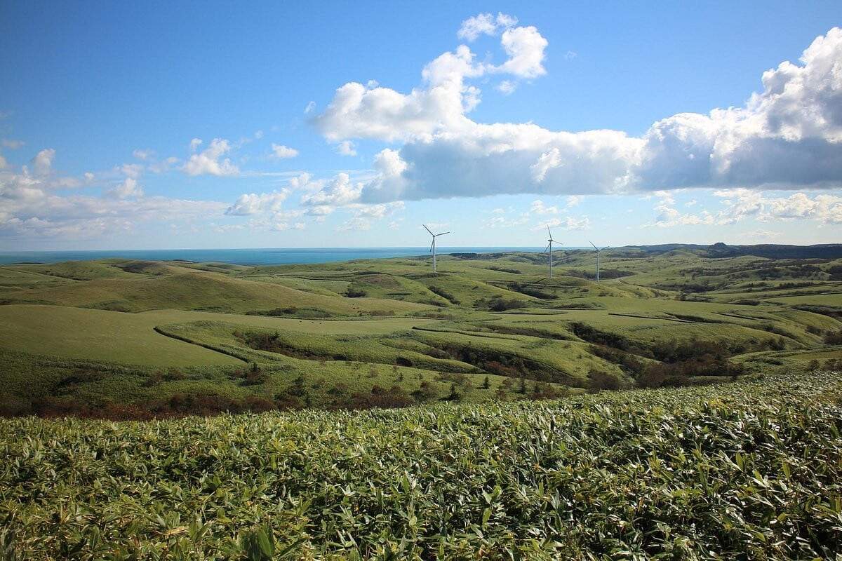
The rolling hills behind Cape Soya are periglacial terrain formed by repeated freezing and thawing in the Ice Age, pushed down toward the sea layer by layer like frozen green waves. This landscape was designated a Hokkaido Heritage site in 2004.
The hills have many white wind turbines and also graze the locally raised Soya Black Cattle, a scene nothing like the usual image of Japan. There is no public transport in this area, so you can only drive or join a sightseeing bus. Roads are mostly single-lane with open views, so watch for grazing animals that suddenly appear.
The White Road: A Snow-White Path Paved with Scallop Shells
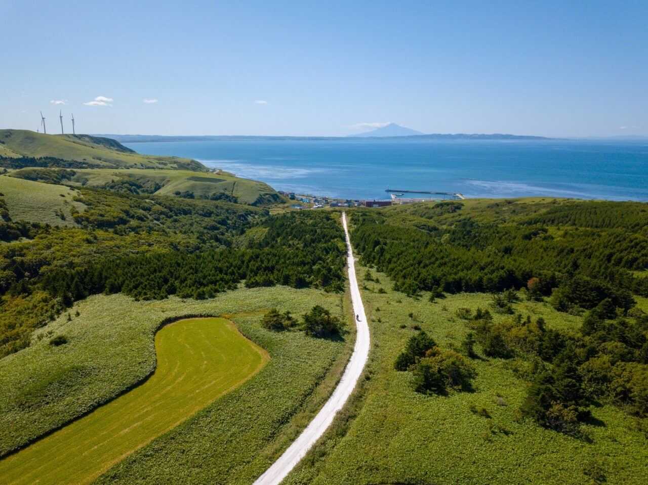
The most famous stretch in the Soya Hills is the “White Road” (Shiroi Michi), about 3 km long and paved entirely with crushed, discarded scallop shells. The white surface, green grass slopes and blue sea pressed together make it Wakkanai’s most photogenic scene.
The surface is gravel, so drive slowly, and there is limited room for passing. The road is generally open only in snow-free seasons and is usually closed in winter. Because of its remote location, navigation may not find it, so pick up a map at the tourist information desk at Wakkanai Station before you set out. Actual road status is as announced locally.
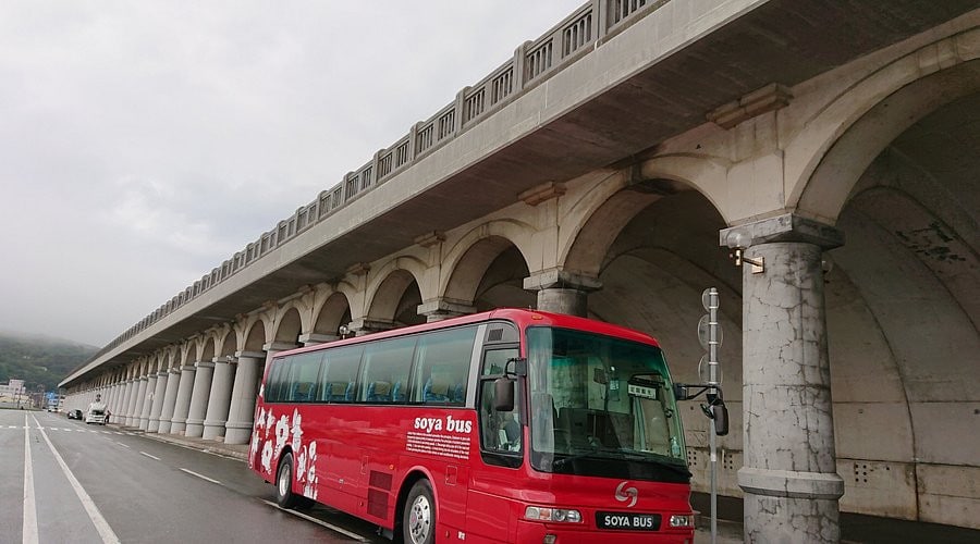
Wakkanai Port North Breakwater Dome: A Breakwater Like a Temple
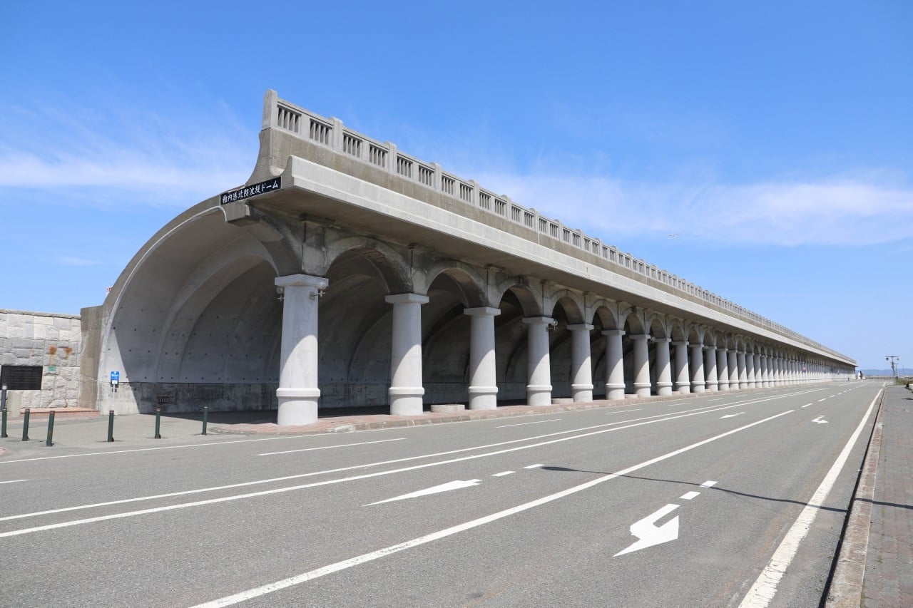
A huge half-arch structure right next to JR Wakkanai Station, 427 meters long and supported by 70 columns, it looks like an ancient Roman colonnaded temple. It is actually a practical facility built in the early Showa era to protect passengers on the Karafuto route from wind and waves.
Today it is a Hokkaido Heritage site and one of the best places to photograph in Wakkanai, where the perspective of the column rows stretching ahead looks dramatic even on cloudy days. It is just a few minutes’ walk from the station, open all day and free to visit. The sea wind is strong, so watch your footing on the slippery ground while taking photos.
JR Wakkanai Station: The Northernmost Rail Terminus in Japan
The northernmost station on Japan’s rail network, with a “northernmost railway line” marker at the end of the platform, and a reason many rail fans make the trip. The station is a modern complex that also houses a roadside station (michi-no-eki), a tourist information desk, a movie theater and restaurants.
For travelers, it is the hub for leaving luggage, gathering information and buying souvenirs, and checking the bus timetable here before heading to Cape Soya is standard practice. The plaza in front of the station also keeps a short section of the old platform’s track and a buffer stop, which you can look at too.
Cape Noshappu: Where the Sunset Sinks into the Sea
A cape jutting into the Sea of Japan on the west side of Wakkanai town. It is a completely different place from Cape Soya and often confused with it: Cape Soya is for the “northernmost point,” Cape Noshappu is for the sunset.
At dusk the sun sinks straight into the horizon, and the silhouette of the dolphin-shaped monument against the sunset is the signature scene. On clear days you can also see the outline of Rishiri Fuji. The cape is windy and exposed, so bring a windproof jacket. It is about a ten-minute drive from town, and city buses also go there.
Wakkanai City Noshappu Cold Current Aquarium: Japan’s Northernmost Aquarium
Right next to Cape Noshappu, this is Japan’s highest-latitude aquarium. It is small but has a very clear theme, showing cold-water fish of the Soya waters, including king crab and various local catches, plus an outdoor seal pool. Admission is shared with the neighboring Youth Science Museum: ¥500 for high school students and older, ¥100 for elementary and junior high school students, and free for preschoolers. It closes for renovation twice a year: from December 1 to January 31, and from April 1 to April 28.
The building is connected to the adjacent Youth Science Museum, and you can usually visit both together, which makes it a good backup plan with children or in bad weather. It has closed periods in winter, and opening hours change with the season, so check before you go. Actual admission and opening hours are as announced by the facility on the day.
Wakkanai Park and the Ice and Snow Gate: A Memorial Space on the City’s High Ground
A large park on the high ground west of town, quite spacious and famous for mid-May cherry blossoms and the night view from above. Its best-known feature is the “Ice and Snow Gate,” officially the Memorial to the Karafuto Islanders.
The monument consists of two gate pillars about 8 meters tall with a bronze statue of a woman in the center, commemorating those who lost their lives in Karafuto. The park also has a tower commemorating the 100th year of settlement, with an observation space and the Northern Memorial Hall, taking in Wakkanai town and the sea at a glance. Actual opening hours are as announced by each facility.
Fukuko Market: Seafood, Hot Springs and a Showa-Era Streetscape in One Place
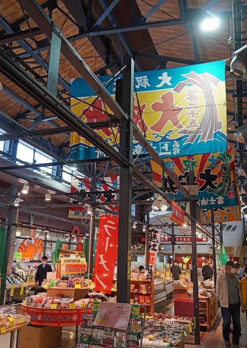
Wakkanai’s largest tourist market sits right by the harbor. Inside, a Showa-era shopping street scene recreates old Wakkanai, with shops on both sides selling local scallops, crab, sea urchin and kelp, plus a dining area where you can eat seafood rice bowls on the spot.
More unusual, there is a hot spring facility on the second floor where you can look out over Wakkanai Harbor as you soak. It is the most useful backup plan in bad weather and the top place to buy souvenirs. Browsing together with Wakkanai dairy products and northernmost-themed souvenirs, it is easy to overspend. Actual business hours and shop closures are as announced on site.
Tickets and Tours
Wakkanai has few paid attractions, and money goes mainly to transport and island ferries. The following five items are the ones most often put into itineraries, and prices and times are all as announced by each operator on the day.
Wakkanai Scheduled Sightseeing Bus: Cover Cape Soya in One Trip
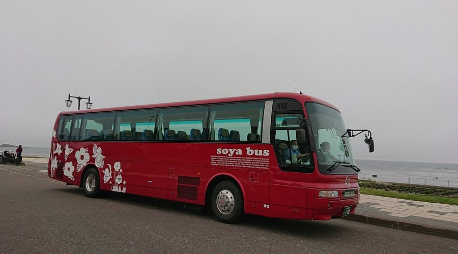
A sightseeing bus tour running from May to September, planned by the local bus operator, stopping at Cape Soya and other main nearby sights, with some tours also covering the Soya Hills section. For travelers who do not drive and worry about too few scheduled buses, this is the most stress-free solution.
Tours usually depart from in front of Wakkanai Station and last half a day to a day, with advance reservations required. Operating periods, route contents and fees change every year; for official information, see the Soya Bus website (soyabus.co.jp).
Northernmost Point Arrival Certificate: Buy It Right Next to the Monument
You can buy it at Kashiwaya (Saihoku Kanko) next to the monument at Cape Soya, where the shop fills in your arrival date and time for ¥100, the classic souvenir here. There is also a completely free “Four Extremes of Mainland Japan Northernmost Arrival Certificate,” available at Base Soya inside the Cape Soya observation deck (open summer, 10:00-16:00), Wakkanai City Hall and the tourist information desk. The same shop also sells northernmost-themed postcards and stamps.
The shop’s hours shorten with the season, and in winter it especially tends to close early, so if you arrive on the last bus you may find it closed. To be sure of buying one, plan Cape Soya for the morning or early afternoon. Actual prices and business hours are as announced by the shop.
 KKdayNorthernmost Point of Japan arrival certificate
  KLOOKNorthernmost Point of Japan arrival certificate
Rishiri-Rebun Ferry Tickets: Two Islands Farther North
Departing from the Wakkanai Port ferry terminal is the only scheduled way to reach Rishiri and Rebun Islands. Wakkanai to Oshidomari Port on Rishiri takes about 1 hour 40 minutes and costs ¥3,590 one way in second class; Wakkanai to Kafuka Port on Rebun takes about 1 hour 55 minutes and costs ¥3,950 (fiscal 2026 fares; the fuel surcharge is currently zero).
There is also a route between the two islands, taking about 45 minutes and costing ¥1,800 in second class. From June to September, each of the two routes from Wakkanai has three round trips a day, dropping to two from November to April; the inter-island route has only two round trips even in peak season, and in the off-season only one a day. For detailed fares and schedules, see the Heartland Ferry website (heartlandferry.jp).
Wakkanai Rental Car: The Only Way to See the Soya Hills
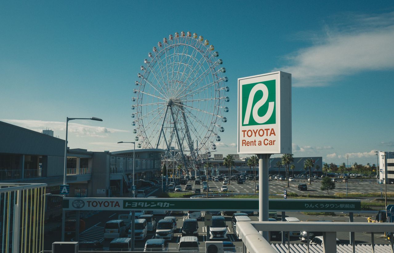
There are rental car offices at Wakkanai Station and Wakkanai Airport. It is about 40 minutes by car from town to Cape Soya, and the White Road in the Soya Hills can only be reached by car, so if your trip includes that stretch, a rental car is almost a necessary investment.
Cars are easily booked out in peak season, so reserve together with your flights. In winter, be sure to confirm snow tires are fitted, and allow extra time for every leg. Actual car models, fees and insurance plans are as announced by the rental company.
Soya Bus Tickets: Money-Saving Options for the Scheduled Bus
The Soya Bus “Commemorative Round-Trip Ticket” is ¥2,880, saving ¥320 compared with two one-way tickets (¥1,600 each), and is sold at the counter in front of Wakkanai Station. There is also the “Wakkanai Route Bus One-Day Ticket” at ¥3,300 (¥1,700 for children), which costs more if you only go to Cape Soya and round trip; it is sold only at the counter in front of the station and gives unlimited rides on city routes, but the Tenpoku Soya Misaki Line is valid only as far as the “Soyamisaki” stop, and sightseeing buses and intercity buses are not covered.
When you buy, confirm the return times for the day; ticket prices are as announced by Soya Bus.
How Much Does a Trip to Wakkanai Cost? Transport, Admission and Ferry Fares
Wakkanai’s cost structure is very different from an ordinary city: admission is cheap, but transport and lodging take up most of the budget. Here are the main expenses broken down.
Getting to and from Wakkanai: Flight vs. Rail
From Sapporo to Wakkanai it is about 1 hour by air and about 5 hours 10 minutes by limited express train. The four-plus hours saved by flying are worth a lot in terms of a day’s itinerary, so if your vacation is only three or four days, put your budget toward the flight.
If you hold a rail pass that covers this section, the marginal cost of the limited express is much lower, and the train becomes the better-value option. Actual fares are as announced by each airline and JR Hokkaido on the day.
Transport Costs in Town and to Cape Soya
The airport shuttle bus to town is ¥800 one way, cash or PayPay only. The scheduled bus from town to Cape Soya is ¥1,600 one way and takes about 50 minutes, and the Commemorative Round-Trip Ticket at ¥2,880 is the best value for a round trip.
If three or more people travel together, a day’s car rental split among passengers is often cheaper than bus tickets plus a taxi, and you can see the White Road. Solo travelers are the opposite: scheduled buses plus the scheduled sightseeing bus work out cheaper.
Admission Costs: Surprisingly Cheap
Wakkanai’s best-known attractions, the Northernmost Point Monument, Cape Soya Park, the North Breakwater Dome, Cape Noshappu, and the Soya Hills and White Road, are all free. The only things that need tickets are the aquarium, the Youth Science Museum and the observation facility at the Centennial Memorial Tower, and all cost only small change.
In other words, admission is hardly a budget concern in Wakkanai. Most people’s spending actually goes on seafood: prices for sea urchin and king crab at Fukuko Market fluctuate with the catch, and that is the real variable.
How Much Extra for the Outer Islands?
If you add Rishiri or Rebun Island, the ferry is ¥3,590 to ¥3,950 one way in second class, so a round trip starts at around ¥7,000-8,000, and visiting both islands adds the inter-island leg.
Transport on the islands is extra too, with rental cars, sightseeing buses or bicycles available, while lodging options are relatively limited and peak-season prices are high. Overall, adding the islands moves the whole budget up a level, so book ferry tickets and lodging early. Actual fares are as announced by the ferry company.
Lodging and Seasonal Price Differences
Lodging in Wakkanai is mainly business hotels around JR Wakkanai Station, plus some inns with hot springs. June to September is the clear peak season, and with summer festivals, room rates and the difficulty of booking rise noticeably.
Off-peak rates drop considerably, but you take on the risk of weather and reduced services. If your plans are firm, book at least two or three months ahead. Actual room rates are as announced by each lodging and booking platform on the day.
What to Watch Out for in Wakkanai: Bus Schedules, Strong Wind and Lodging Tips
The risks of a Wakkanai trip lie not in the sights but in transport and weather. Think through these three things beforehand and the trip will go much more smoothly.

The Thing Most Likely to Ruin a Day: Bus Schedules and Last Buses
The scheduled bus to Cape Soya has only four outbound runs a day, and the last return from Cape Soya to Wakkanai Station is at 15:20. Many people arrive at the cape only to find they must wait several hours for a return bus, or that there is none, and end up paying a taxi fare of over ¥10,000 to get back to town.
The only solution is to confirm the timetable fully before you leave: ask at the bus terminal in front of Wakkanai Station about that day’s runs, photograph the return bus stop sign as soon as you get off, and work backward from the return time to see how long you can stay at the cape. If your timing is too tight, switching to a scheduled sightseeing bus or a rental car is much safer.
What to Bring: A Windproof Jacket Even in Summer
Wakkanai is windy all year, and Cape Soya and Cape Noshappu are completely exposed. Even in July and August, the felt temperature by the sea can be only around 10-something degrees, and standing on the cape in short sleeves is too cold to bear. Treat a windproof jacket and long pants as essentials.
Choose shoes that are comfortable and grippy. Cape Soya Park has slopes and steps, more noticeably so with snow and ice in winter. The White Road is gravel, not suitable for walking far in thin-soled shoes. Cameras easily get sea salt in strong wind, so bring a storage pouch.
Which Area to Stay In: Lodging Tips
Travelers without a car should choose around JR Wakkanai Station and the ferry terminal first. This area has a concentration of business hotels and some hot-spring inns, connects to the bus to Cape Soya as soon as you leave the station, and is only a few minutes’ walk for the ferry to the islands the next day.
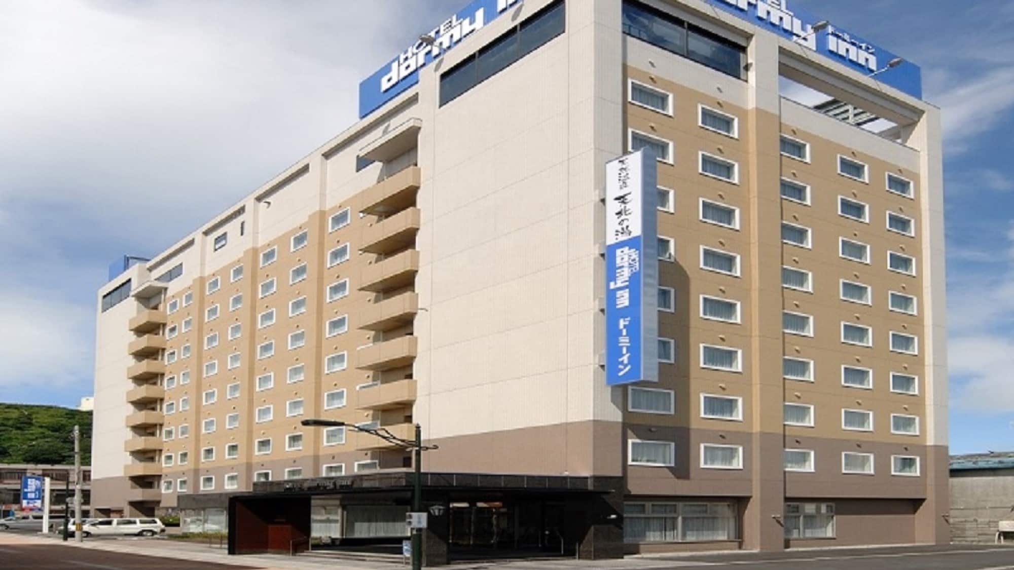
If your trip is mainly by car, there are a few lodging options on the outskirts of town or toward Cape Soya, with the advantage of leaving earlier the next day and avoiding sightseeing bus crowds. If you plan to stay overnight on Rishiri or Rebun, lodging on the islands is limited and in high demand in peak season, so book well in advance. For lodging options and price comparisons in Wakkanai town, see our dedicated lodging guide.
Wakkanai and Cape Soya FAQ
Q: Is Cape Soya really Japan’s northernmost point?
It depends on the definition. The Northern Territories, over which the Japanese government claims sovereignty, lie at a higher latitude, so strictly speaking Cape Soya is the northernmost point “excluding the Northern Territories.” Offshore from the cape there is also the uninhabited Benten Island, slightly farther north than the cape itself, but landing is not allowed. So for ordinary travelers, Cape Soya, with its triangular monument, is the northernmost point of Japan you can actually stand on.
Q: How long does it take to get from Sapporo to Wakkanai?
By air from New Chitose Airport it is about 1 hour, and with the time to and from the airport the move can be done within half a day. The JR Limited Express “Soya” direct takes about 5 hours 10 minutes (once a day), a “whole half day on the train” level. There is also an overnight intercity express bus taking about 6 hours, the cheapest option. Actual schedules and fares are as announced by each operator on the day.
Q: Can I get to Cape Soya without a car?
Yes, but be very careful with schedules. From the bus terminal in front of Wakkanai Station, the Tenpoku Soya Misaki Line takes about 50 minutes and costs ¥1,600 one way. The problem is that there are only four outbound runs a day and the last bus back from Cape Soya to town is at 15:20 in the afternoon, and if you miss it the taxi fare can exceed ¥10,000. Confirm that day’s timetable at the bus terminal before you set out, or take the scheduled sightseeing bus that runs in summer (the 2026 operating periods were 5/3-5/5 and 5/20-9/30 and have ended; for 2027, go by the operator’s announcement; advance reservation required).
Q: Are Cape Soya and Cape Noshappu the same place?
No, this is the most common mix-up. Cape Soya is about 30 km northeast of Wakkanai town and is Japan’s northernmost landmark; Cape Noshappu is on the west side of town, about a ten-minute drive away, known for the sunset sinking into the Sea of Japan. They are two completely different sights and should be scheduled separately.
Q: How many days are right for Wakkanai?
For Wakkanai town and Cape Soya only, two days and one night is plenty: the first afternoon for town and the Cape Noshappu sunset, the second morning dedicated to Cape Soya and the Soya Hills. If you add Rishiri or Rebun Island, allow at least two more days, because ferry crossings and schedules take up a lot of time.
Q: How do I get to the White Road, and can an ordinary car drive in?
The White Road is in the Soya Hills behind Cape Soya, about 3 km long, with no public transport, so you can only drive or join a sightseeing tour that includes this stretch. The surface is gravel made of crushed scallop shells; ordinary vehicles can pass but must slow down. The road is closed from mid-November to late April each year (in 2026 it opened on April 24). In addition, in 2026 the Cape Soya wind farm is replacing its turbines, and from May to October there may be temporary traffic control around the White Road and the Soya Hills hiking routes, so check local announcements before you go.
Q: What is the best season to visit Wakkanai?
June to September is the most recommended window, with stable weather, ferries and scheduled sightseeing buses running, and Rebun Island’s alpine flowers in bloom. Winter has heavy snow and wind, transport often suspended and sharply reduced island ferries, so it is better suited to experienced travelers. Note that Wakkanai is not a main drift-ice viewing area; for drift ice, head to Monbetsu and Abashiri on the Sea of Okhotsk side.